Hurricane experts have already raised alarms about the effect the Trump administration’s slashing of science budgets could have on hurricane research.
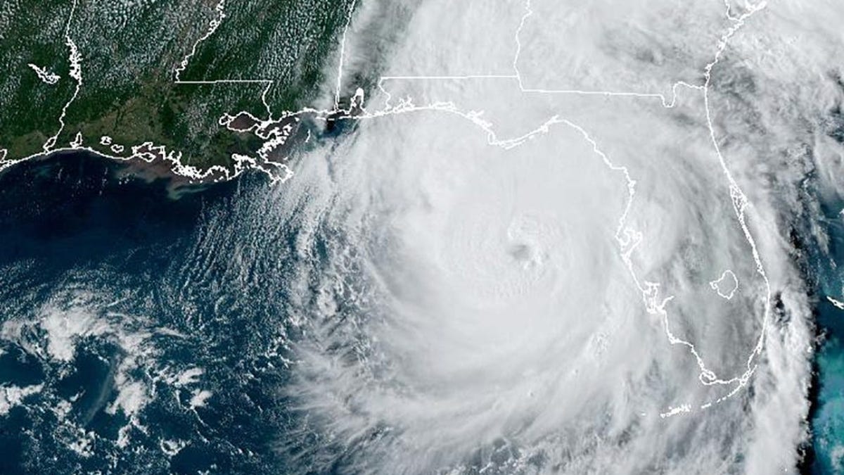
Hurricane Erick hits Mexico as category 3
A small town in Oaxaca, Mexico, was hit with the first hurricane of the season, Hurricane Erick, as a category 3.
The Defense Department is cutting off weather forecasters from data gathered by its special satellites that can “see” through the clouds, a move experts say could deprive hurricane researchers of key information as hurricane season kicks into gear.
“It’s just going to make researchers have to work even harder to get to the results,” said Jill Trepanier, a hurricane climatologist and chair of Louisiana State University’s department of geography and anthropology.
The “permanent” cutoff puts a stop to the distribution of all data collected by three military-run satellites, according to a notice release June 25 by the National Oceanic and Atmospheric Association. The Pentagon first announced that data cutoff would take effect June 30 but later pushed the date back to July 31.
The satellites are equipped with unique tools to peer beneath cloud cover and capture microwave images that forecasters can’t get anywhere else. Their infrared sensors capture images over an area of 1,600 nautical miles, beaming down information twice every day.
Launched between 2003 and 2009, the satellites orbit Earth every 101 minutes at an altitude of about 515 miles, according to NASA. They track weather patterns over remote areas, including “fog, severe thunderstorms, dust and sandstorms, and tropical cyclones,” according to the Space Force.
The Navy confirmed the data cutoff, adding that the satellite program was already “scheduled for discontinuation in September 2026.”
The Space Force referred questions to the Navy, which it said was responsible for the change.
Even as the Navy “is making a change on their end, the posture on sharing DMSP (Defense Meteorological Satellite Program) data has not changed,” the Space Force said in a statement. The satellites and instruments “are still functional,” and Defense Department users “will continue to receive and operationally use” data from them.
‘People could die’
Hurricane experts have already raised alarms about the impact the Trump administration’s slashing of science budgets could have on hurricane research. As tropical areas brace for storms, the satellite data cutoff could exacerbate the problem, they say. Hurricane season begins in June and ends on the last day of November.
“We’re back to tracking hurricanes like it’s 1999. Except this isn’t a party. And people could die,” John Morales, a three-decade TV meteorologist specializing in hurricanes, wrote in an NBC op-ed. The military satellites “provide critical information that regular weather satellites can’t,” he wrote.
The change will “severely impede and degrade hurricane forecasts for this season and beyond, affecting tens of millions of Americans who live along its hurricane-prone shorelines,” Michael Lowry, a hurricane specialist and storm surge expert, wrote in a Substack article. The three military-run satellites provide roughly half of microwave satellite scans to forecasters, Lowry wrote.
Trepanier said data from the satellites helps track “rapid intensification” of hurricanes and to “see the structure as the storm is forming,” which today represents “probably the weakest puzzle piece” in modeling hurricanes.
“The biggest threat” was the suddenness of the shutdown, which left researchers “reeling,” Trepanier said.
“It’s frustrating when you have something that’s available that could make it easier” for researchers to focus on “other aspects of that storm’s trajectory,” she added.
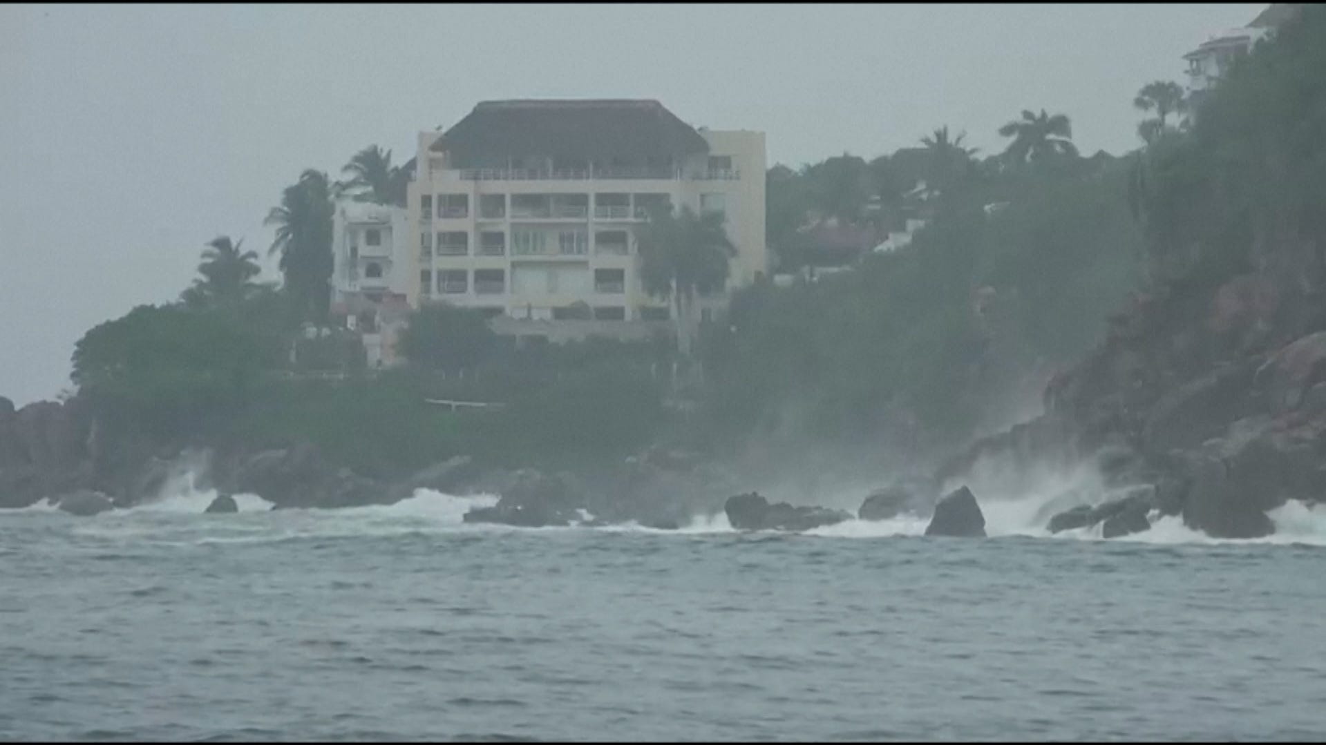
Forecasters have warned that Flossie, which strengthened to a tropical storm on June 29, could become a hurricane within days. The storm was about 155 miles southwest of Zihuatanejo, on Mexico’s Pacific coastline, on June 30 and was expected to pass off the Baja California Peninsula over the next days.