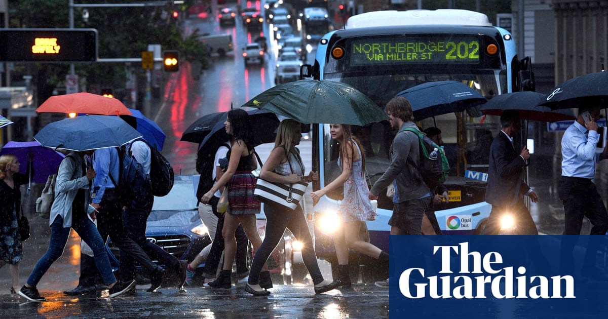
Persistent rain and strong winds will sweep across New South Wales into the weekend, the Bureau of Meteorology predicts, with parts of Victoria and south-east Queensland also likely to be affected.
Angus Hines, a senior meteorologist at the Bureau of Meteorology, said Sydney’s weather could shift from storms to a “dreary” mix of wind, rain and cloud. It would be “persistently windy” and “quite chilly”, he said.
While the intense storms that lashed Sydney on Wednesday had developed in Victoria and swept east, a low-pressure system in the Tasman Sea would feed strong winds and rain on to the east coast of NSW, he said.
That same weather system was expected to affect parts of eastern Victoria and south-east Queensland. The bureau has warned of damaging winds, hail and heavy rainfall for parts of the Gold Coast.
Eastern NSW, particularly the northern rivers region, was at the highest risk for severe thunderstorms on Thursday, Hines said, with more heavy rain, damaging winds and possibly large hail expected.
The Hunter and mid-north coast could also expect heavy rainfall and damaging winds over the next 48 hours.
On the other side of the country, Western Australia faces the highest risk of a tropical cyclone so far this season, according to Hines.
“The most likely impact of that would be some heavy rainfall around the Pilbara and northern WA, strong winds particularly near the coast of the Pilbara,” he said.
Large waves were likely along the northern WA coastline.
Hot weather would continue across north-eastern Queensland, he added. Severe intensity heatwaves were forecast from Bundaberg to north of Cairns.
“Lots of those areas are between four and eight degrees warmer than usual for this time of year during the day,” Hines said.
Wednesday’s thunderstorms produced 1.2m lightning strikes, damaging wind gusts above 100km/h in many areas, and sharp bursts of rain. “It was very dramatic,” he said.
“Pretty much everyone from Melbourne up to Sydney and all areas in between, including across Canberra, would have seen a taste of that … as that band of storms swept through.”
Wind gusts up to 107km/h were recorded at Sydney airport, 109km/h in Newcastle and 120km/h in Williamtown.
While most rainfall totals were between 20mm and 40mm, Eurobodalla on the NSW south coast was drenched with 127mm.
after newsletter promotion
The weather caused significant damage and widespread power outages.
More than 143,000 households and businesses across NSW lost power– approximately 90% due to lightning strikes, according to Ausgrid. Northern Sydney, the Hunter and Newcastle regions were hardest hit.
Ausgrid said crews had worked through the night to restore power to 50,000 homes and businesses. They were focused on returning power to remaining customers as quickly as possible.
The State Emergency Service received more than 2,250 calls and responded to 1,800 incidents.
A man in his 80s died at Cowra after a tree fell on his vehicle, the SES said.
Parts of Queensland were also in the firing line later on Thursday with severe thunderstorms with damaging winds and large hailstones cutting a swathe across the state’s southeast.
Areas affected included Brisbane, the Gold Coast, Sunshine Coast and Gympie, with trees uprooted and power cut to thousands of homes on Thursday afternoon.
Australia’s land surface has warmed by 1.5C since 1910, according to the BoM, making heatwaves longer and more intense. The climate crisis was causing the number of extremely hot days to increase.
– with Australian Associated Press


